Death Valley Workshop February 9-12, 2014 Trip Report
[photoshelter-gallery g_id=”G00005VSMmG.hFMI” g_name=”Death-Valley-Images-February-9-2014″ width=”600″ f_fullscreen=”t” bgtrans=”t” pho_credit=”iptc” twoup=”f” f_bbar=”t” f_bbarbig=”f” fsvis=”f” f_show_caption=”t” crop=”f” f_enable_embed_btn=”t” f_htmllinks=”t” f_l=”t” f_send_to_friend_btn=”f” f_show_slidenum=”t” f_topbar=”f” f_show_watermark=”t” img_title=”casc” linkdest=”c” trans=”xfade” target=”_self” tbs=”5000″ f_link=”t” f_smooth=”f” f_mtrx=”t” f_ap=”t” f_up=”f” height=”400″ btype=”old” bcolor=”#CCCCCC” ]
Trip Report: Death Valley Workshop February 9-12, 2014For this unique workshop adventure I had the honor of being guide and instructor to members of The Villages Camera Club from San Jose. This amazing group of dedicated photographers includes experienced photographers as well as some beginners. Whether veteran or novice they all shared the same enthusiasm to explore, improve their photography and have a good time. The plan was to photograph some of Death Valley’s iconic vistas as well as some lesser known locations. We were joined on a few of the excursions by my brother, Peter. A retired USGS scientist and naturalist, Peter was able to not only identify plants and birds, but give us a geology lesson or two along the way. Day 1 We began the workshop photographing the Mesquite Flat Dunes at dawn. There had been no cleansing winds for several weeks and the dunes were covered with more tracks than I had seen in previous years. My brother and I scouted the dunes in the days prior to beginning of the workshop and discovered a remote section of the dunes that were relatively untracked and still offered great photographic possibilities. The trek to the dunes began in the dark with a 1.25 mile walk. As the sky grew lighter the landscape revealed many exciting compositions among the vegetation and mud pans scattered between the dunes. After photographing the Dunes we returned to Stove Pipe Wells for breakfast and to prepare for the afternoon excursion. During this time I met with many of the photographers in the group to answer questions and help them with equipment, technique or composition questions. At 12:30 we departed for the Death Valley Visitors Center. The Visitors Center at Furnace Creek has free wi fi and a cellular connection so everyone could catch up on messages. For many first time visitors in the group this was also an opportunity to learn about the ecology, culture and history of Death Valley. The next stop was Artists Drive. This is a scenic one way road that winds through some spectacular scenery and culminates at what is known as the Artist’s Palette. It is named for the multi colored mineral deposits that cover the hills and look very much like an artist had dribbled paint over the landscape. In the mid to late afternoon this is a good place to introduce photographers to correct use of a polarizing filter. For the sunset we travelled to Badwater Basin. At 282 feet below sea level this is the lowest point in North America. It is also home to some unique polygonal salt formations that spread across the basin. The ridges of salt crystals that form the polygonal shapes make this a popular photo location. After dinner at Furnace Creek it was back to the lodgings at Stovepipe Wells for some more photo help and discussion.
Day 2 Dawn on day 2 found us heading south before sunrise to Zabriskie Point. This is a popular location in Death Valley to view and photograph the sunlight as it gently and swiftly illuminates the formation known as Manly Beacon. This formation and the surrounding canyons are made up of yellow mud deposits that are the remains of a glacial lake that filled the valley during the Pleistocene. Once the sun is up the textures in the canyons make for awesome photographs as well. After breakfast at Furnace Creek we visited the remains of the Harmony Borax Mill. This site is where the era of the twenty mule team wagon was born. These wagons were loaded with 22 tons of borax. Teams of 20 mules were used to pull these double wagons along with a water tank from Death Valley to the railhead in Mojave. This was a grueling 10 day trip through “the back door to hell”. After a brief visit to the Salt Creek Nature trail we headed to Scotty’s Castle for a picnic lunch. This desert oasis was built by Albert Johnson as a vacation home. Mr. Johnston and his wife Mabel were friends and benefactors of the notorious Death Valley Scotty, the Castles namesake. Scotty actually lived in a ranch close by, but was a frequent visitor who would entertain the Johnston’s guests with outrageous stories. The castle grounds are a rich ground for photo opportunities. The unique architecture of rambling courtyards among red tile roofs includes many details such as a spiral staircase and a clock tower. There are also some old abandoned cars in nearby Tie Canyon. What photographer can resist the opportunity to photograph a rusting car hulk? While most of us were out photographing old cars and exploring the castle one of our group, Bob, patiently waited in the picnic grounds for an opportunity to photograph a coyote prowling nearby. He was rewarded with an incredible shot of the coyote leaping in an attempt to catch a rodent for lunch. For our second sunset of the trip we visited Ubehebe crater. The shadows on the crater rim in the last light of the day made the craters textures stand out in strong relief. This was an opportunity for some of the advanced photographers in the group to break out the panoramic gear. We returned to Stove Pipe Wells for dinner, a well deserved rest and an evening question/answer session. Day 3 The Devil’s Cornfield was our sunrise destination this morning. After the long drive of the day before this was an easy 10 minutes down the road from Stovepipe Wells. Thickly clumped stems of arrowweed (Pluchea sericea) grow on narrow mounds resembling harvested sheaves of corn. At sunrise the back light creates a ghostly harvest for photographers. There are also great images to be found when the plants are sidelit against the dark backdrop of the Panamint Mountains. After breakfast at Stovepipe Wells we had a morning break out session before heading to the ghost town of Rhyolite in nearby Nevada. Rhyolite and the nearby Goldwell open air art museum were a big hit. No matter what season or what time of day I visit Rhyolite I always find something new to photograph. For Sunset we drove back to Death Valley and stopped to take panoramic photographs of the Mesquite Flat Dunes. After dinner we adjourned to the auditorium for a slideshow and critique of photographs from the previous days. Day 4 This was our last morning and since many of the group had long drives home ahead most of us slept in. A few of the advanced photographers went out for one more sunrise of the Dunes. After a leisurely breakfast and check out we met at Mosaic Canyon for some final photographs. Mosaic Canyon is a showcase of geologic features as well as a beautiful example of one of Death Valley’s many canyons. A short stroll up the canyon reveals walls of polished marble and “mosaics” of exposed rock known as brecchia. Please check out this Gallery for more images; |
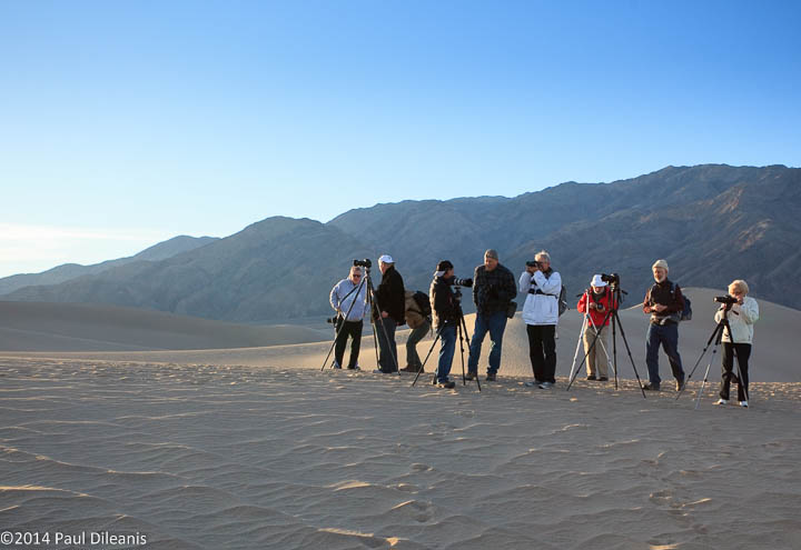 Members of the Villages Camera Club at Mesquite Flat Dunes. Death Valley NP 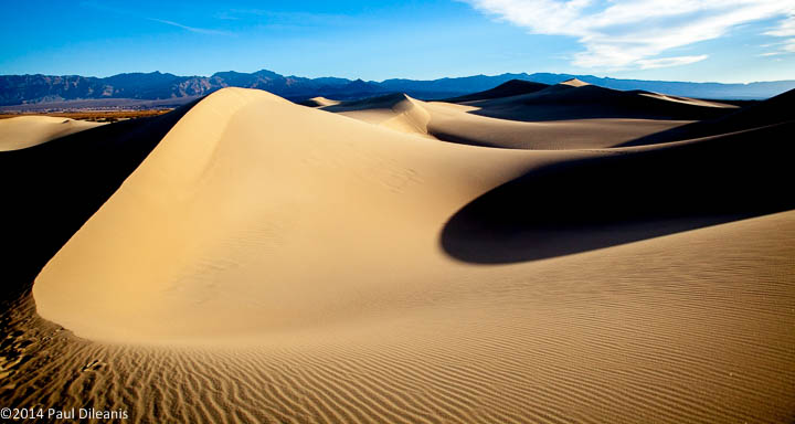 Form and shadow. Mesquite Flat Dunes. Death Valley NP 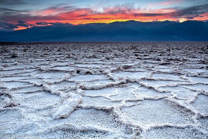 Badwater salt polygon formations. 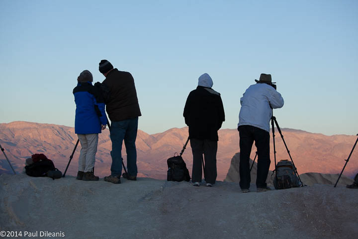 Members of the Villages Camera Club wait for the sunrise. Zabriskie Point. Death Valley NP 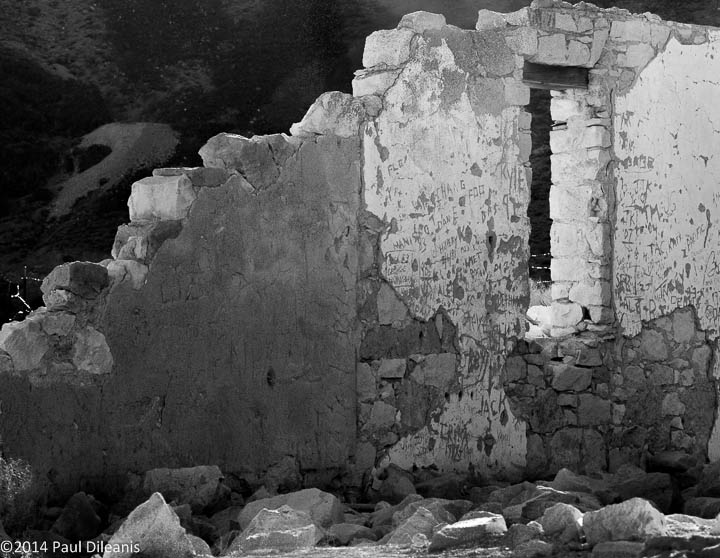 Rhyolite Ghost Town, Nevada 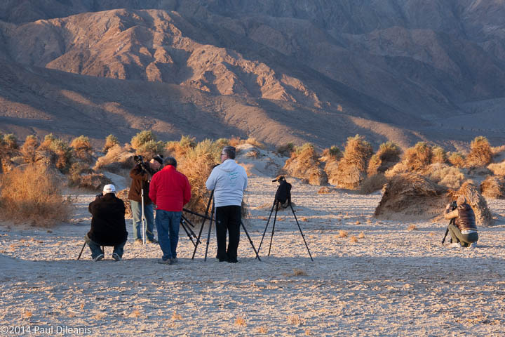 Devil’s Cornfield 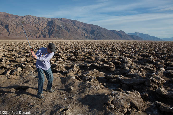 Patti takes a swing at the Devil’s Golf Course. Death Valley NP
|